Lincoln Memorial on I-80
Medicine Bow National Forest
Between Laramie and Cheyenne, just north of I-80, lies some great mountain biking in the Medicine Bow National Forest. The trails change seasonally, and are popular with cross-country skiers in the winter. All areas can be accessed via the Happy Jack and Vedauwoo exits (323 and 329 respectively). Look for the Lincoln state at the Happy Jack exit. The Pole Mountain trails at exit 323 connect with the Vedauwoo trails, so for strong riders that want to put in some miles, it's one riding area, for those looking for sub-20 mile rides, you can consider them two distinct areas.

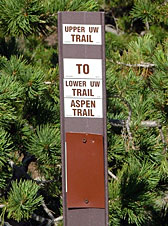
Pole Mt. trail sign
Pole Mountain
There are three trailheads that provide access to the Pole Mtn trails: Tie City, Happy Jack, and Summit. A Day Use Fee of $5.00 is charged at the Tie City and Happy Jack trailheads (season passes are also available.) If I read the rules correctly, it's a parking fee, and not a trail use fee. The trails are well maintained, and, for the most part, well marked. There are also free maps available at the trailhead that are not as complete as the maps from the Pedal House, but far easier to read. I kept losing my way, as there were far more trails on the ground than on the map, but would quickly find myself when the next sign came up (although i wasn't always where i'd wanted to be!) I started at Tie City trailhead at the Happy Jack exit based on multiple recommendations from locals and the local shop.

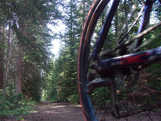
Somewhere in the Happy Jack trails area
Maps:
- Forest Service Area Map
- Happy Jack/Pole Mountain Winter Trails Map
- Pilot Hill Trail Map
- Buy Wyoming Trail Maps and Guide Books
Trail Description
Between the cross country ski trails and the Headquarters trail and all the trails that connect on the east side, there's over 20 miles of single track cutting through aspen groves, stands of pine and fir, and mountain meadows and dozens of more miles of doubletrack and dirt roads. There is some climbing involved if you drop down from the "top" to the base area of the old ski area that was once there (300 to 400 vertical feet). Otherwise, the terrain is mostly flat or rolling. It's not hard to get "a little bit lost" as the trails loop around and cross one another frequently. However, it's hard to get "really lost" so the best thing is to just go out and ride.
It's possible to start your rides at Happy Jack and go to Vedauwoo and back. There are hundreds of miles of dirt roads and trails in the Pole Mountain area of the Medicine Bow National Forest.

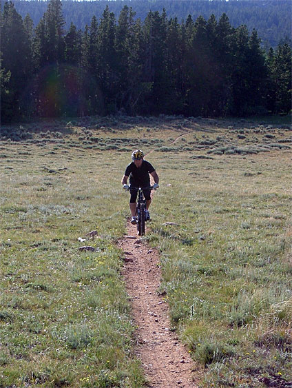
Headquarters Trail
Mountain Biking Vedawoo
The roads (mostly double track) are largely crushed pink gravel. Compared to the Pilot Hill area, they're virtually highways. The scenery is spectacular and there is an immense number of double tracks to ride. There's usually a good race held here every spring. The start/finish area of the '94 race is shown in this picture. I haven't got any route in particular to suggest as I'm still figuring the area out myself (I got lost in the '94 race so how much do you want to trust me?). I don't think you'll be disappointed just exploring.
- Forest Service:winter sports in the Medicine Bow - Routt National Forests
- Medicine Bow Nordic Association (with maps)
How to get there:
Ride your bike
Dental work is more fun, but you can ride up I-80 east out of Laramie and exit at the Lincoln Monument. You can also ride up Pilot Hill starting in Laramie and take the Forest Service road at the top of the ridge south to the Upper Tie City parking lot at Happy Jack. This is quite a ride in and of itself (roughly 13 miles one way with better then 2000' of climbing) and going back is no picnic. For your average or even above average rider, you won't want to expend much energy tooling around the great trails at Happy Jack if you want to make it back to Laramie un-bonked.
Drive your car.
I know this is a bit sacreligious, but a short drive up to the Summit on I-80, parking your car in either the Lincoln Monument Rest Area, Upper Tie City or Happy Jack parking lots will leave you with plenty of energy to cruise some great single track. There's lots of parking at the Lincoln Monument just off the interstate, and the Headquarters Trail begins just north of the parking lot. To get to Upper Tie City or Happy Jack parking lots, exit at the Lincoln monument and head north on Happy Jack Road (Wyo 210) about 1 mile (Upper Tie City) or 2 miles (Happy Jack) and turn right into the respective parking lots.
The Vedauwoo exit is about 20 miles east of Laramie (and therefore about 25 miles west of Cheyenne). Vedauwoo proper is a picnic area with fabulous rock climbing and hiking opportunities. You can park in Vedauwoo and ride out of there, but it is best to cruise down the dirt road past the entrance to the picnic ground and turn off on one of the many side roads and park.
Pilot Hill MTB Trails
"Pilot Hill" in this ride guide encompasses the area east of Laramie, North of I-80, south of Roger's Canyon (9th Street), and up to the summit of the hills to the west. If you find your way from Laramie to the top, you'll be climbing anywhere from 1400 to 1600 ft (from 7200' to 8800'). Many of the trails are as rough and rocky as you'll ever find and can make the downhills a torturous experience. There's a lot of territory out there, and there are a very large number of possible rides. My best advice is to ride and explore, but there are a few standard rides worth pointing out. By the way, leave the sheep alone.

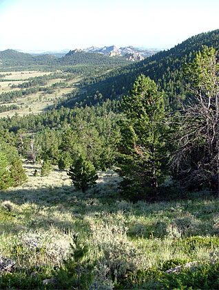
Looking south to Vedauwoo from HQ trail
The Cactus Track
This is a nice single track that winds its way up a gully to a windmill and water tank (about 2.5 miles of single track). Once there, you can return via the same route (exhilarating) or you can continue up the double track about 1 mile to the east end of the Windmill Ride. Don't stray from the track as the trail is aptly named. It's about six miles from the University to the windmill and watertank at the east end of the Cactus Track.
If you're departing from the University of Wyoming, you've got about 2 miles of pavement: east on Willet Dr. to 30th, north on 30th to Grays Gable Rd., east on Grays Gable Rd. to Indian Hills Dr. where you turn left (north) and ride a few blocks to the end of the pavement.
Once off the pavement, ride north on the double track about 0.5 miles until the power substation is on your left and the twin set of double poled power lines are more-or-less overhead. Turn right (east) and follow the power line road for about 50 yards, until you pass through the fence. Immediately hop up on the left hand double track that appeares and follow it as it curves off to the northeast. About 0.5 miles after passing through the fence, the Cactus Track will appear on your right.
The Windmill Ride
There are several windmills and watertanks scattered around the Pilot Hill area. One can be found on the east end of the Cactus Track, one can be found on the "flats" well north of town, but this ride will take you to a windmill and watertank about half-way to the top of the ridge via a very rocky double track. It's just north of the gully that the Cactus Track is in. The water tank at this site is worth examining as it is completely covered with hieroglyphics. There is some very classy stuff from years back, most of it in Spanish, left by the sheep herders who use this tank. This windmill and water tank are about five miles from the University, about three of it off-road. It's a very rocky three miles with at least 800 feet of climbing.
To get to the Windmill/Watertank, follow the directions for finding the start of the Cactus Track, but do not turn up the power line road. Continue instead about a quarter mile further north and turn right (east) at the next available road. It goes straight east on the flats for a half mile or so befor winding it's way up the hill to the windmill and water tank, about 2 miles from where you turned east. You can continue up the track from the windmill (east) about 1.5 miles to the top of the ridge. Just before getting to the ridge, a faint track to the south will get you to the east end of the Cactus Track which will take you back down. If you were to skip the turn-off to the Cactus Track and continue east another quarter mile or so, you'd get to the double track that traverses the north/south ridge of the Laramie range. Head south to Pilot Hill (see below) or north towards Roger's Canyon and the eastern end of the Stock Pen Trail (also described below).
The Stock Pen Trail
This trail is the next trail north of the Windmill Ride and combines with either the Cactus Track or the Windmill Ride to make an entertaining loop. I usually ride it from east to west (i.e., downhill) 'cause it's rather steep in places.
The east end of the Stock Pen Trail is about a half mile north of where the Windmill Ride joins the north/south ridge trail on the west edge of the Laramie range. The trail heads immediately downhill (a fast double track) for about a mile and then surges up a hill for a hundred yards or so. At the top of the hill is a stock pen. You proceed around the north edge of the stock pen (keep it on your left -- you're headed primarily to the west) and pick up the rocky double track down the hill. Mark bunny hopped a ticked-off badger here recently, so keep an eye out. This downhill, steep in places, continues for about 1.5 miles. As you join another road (part of the Antelope Trail), ride east along the fence line until you pass through a north/south running fence, turn south and ride about 1.5 miles or so to the trail head at Indian Hills Drive. Note that you'll pass the turnoffs for the Windmill Ride and the Cactus Track on your way back to Indian Hills Drive.
The Antelope Ride
If you want a ride without much climbing and lots of antelope and coyote sightings, exit the pavement off from Indian Hills Drive (as you would for the Cactus Track) and continue north on the dirt past the turnoffs for the Cactus Track and the Windmill/Water Tank rides. Continue north for about another mile, at which time you'll encounter a fence. Turn left (east) and parrallel the fence. You'll want to turn left (north) after a half mile. At this time you can keep heading north or branch off up into the hills via the west end of the Stock Pen Trail. This route into the hills is quite steep but can be fun -- you'll ultimately end up on the ridge road and can connect into the Windmill, Cactus Track or Pilot Hill trails to the south. If you continue on the flats to the north, you'll encounter yet another windmill after about a mile. Head west at this point for about a half mile and then turn south and in about another mile or so you'll link up with the double track that will take you back to Indian Hills Road on the east side of Laramie.
Getting to Pilot Hill and Back Down
Straight up Pilot Hill:
For the most direct assualt on Pilot Hill, take Grand Ave. east past Walmart and then turn left at the first possible road (Boulder Drive, a dirt road). Follow this road for about two miles as it winds it's way east and a bit north toward the foot of Pilot Hill. There are any number of double tracks that branch off, but if you stay on the main track, you'll eventually (roughly 2 miles) encouter a line of telephone poles running in an east/west direction. Turn right (east) and follow the line. You'll cross a flat, solid rock plain for the first quarter mile or so, then dip down through a gulley and up the other side. At this point follow the northeast branch and continue until you encounter the telephone lines again and follow them to the summit of Pilot Hill (where the radio and TV antennae are). The last half mile or so up the west face of Pilot Hill is quite a grind. If you really want to get to the summit of Pilot Hill, follow the double track that loops around the south side of the hill and then loops to the summit from the east side.
From the North of Pilot Hill:
If you make it to the top of the ridge north of Pilot Hill via the Stock Pen, Windmill or Cactus Tracks, you can turn south and eventually connect with the double track that follows the east/west power lines. It's worth noting that heading up the power lines (see the Cactus Track discription) is a good way up to the top of the ridge, but I wouldn't recommend following the power lines west (downhill) as the trail is extremely rocky and I doubt even full suspension would make it fun. Instead, go east with the power lines a few hundred feet, and take a right (south) and ride a very pleasant trail towards Pilot Hill (the high point on the ridge with the radio towers on top). After about a mile of this trail, you'll end up on the west face of Pilot hill, just below the summit. One of the best (and only) ways down is straight down along the telephone poles. It's pretty obvious which way to go -- keep heading towards the Snowies and you'll eventually hit Laramie.
From the South of Pilot Hill:
I've only found two ways up to the east ridge of the Laramies south of Pilot Hill (and north of I-80). One is very sandy and the other is very rocky. Neither are particularly pleasant. If by chance you find your way to the top of the ridge south of Pilot Hill, you'll eventually connect in with a Forest Service road (#703) that you can take north towards Pilot Hill. As road #703 swings east, you'll need to branch off north to get to Pilot Hill proper. Once on Pilot Hill, find your way around to the west face (loop around the south side) and follow the powerlines/telephone poles down.