Denver Area Front Range Trails
Denver has a great selection of rides very close to it, in the foothills of the front range. From sunny Green Mountain, that you can often ride in the winter, to shady Buffalo Creek, that you can ride on the hottest days. The trails tend to be hard-packed, and many are rocky. There is not much mud, like east coast riding, and you should stay off the trails when there is! All-in-all, rides accessible from Denver offer a hell of a lot more than you'd expect.
There are a lot of great shops in Denver. My favorite shop in Lakewood/West Denver is West Side Cycling and Fitness. The staff is very knowledgeable, and super friendly. The shop is small enough to give more personable service than I'm used to, yet big enough to usually have what you need in stock. Turin is my fave shop downtown. Not far from town is probably the most knowledgeable shop in the area:
Cycle Analyst Inc
722 South Pearl St.
Denver, CO 80209
303.722.3004
They don't have a website, which totally fits their style. They aren't a sparkly clean shop with plenty of salespeople. Instead, they know how to fix anything, and can offer new and used replacement parts. They are universally recommended by other shops in town when they can't fix something. Cycle Analyst is a genuine old-school shop. You'll feel good spending your money there, instead of with some mega corporate-owned shop.
Other great shops are: Wheat Ridge Cyclery, Mojo, and many others. Everyone seems to have a different favorite.
Alderfer/Three Sisters Park
Alderfer/Three Sisters Park / map / trails profile
Apex Park
map | trails profile
Directions:
Drive west on 6th Ave. and turn left on US-40 (Colfax). Take US-40 to Heritage Square, then turn right onto county road 93. Drive on this road for 1/4 of a mile and turn left into the lower parking lot for Heritage Square.
Buffalo Creek / Colorado Trail
the Buffalo Creek area is very shady, and a great place to ride when Green Mountain is too hot. However, it's a much farther drive from Denver. The Forest Service has more info and a good map and brochure that you can print.
Bear Creek Trail (Pence, O'Fallon, and Corwina Parks)
Bear Creek Trail offers a nice ride, or a great combo with Mt. Falcon, if your feeling up for it. It also connects to Lair O'the Bear Park. Denver Mountain Parks has more info and a good map that you can print.
Dakota Ridge / Matthews Winter
by Aaron Teasdale
map | trails profile
Is it any surprise that Denver has great singletrack? Where it once only nipped the Rockies, this great sprawling beast of a metro now threatens to devour the mountains, the foothills, the farms and spit out one monster cream-colored subdivision. So, yes, it is a bit of a surprise. Denver is a booming city that, sadly, has done a poor job of preserving its urban singletrack. But it's still one of the best cities in the nation for mountain biking because of its neighbors. For rip-roaring trail riding in abundance, go west, young man.
Here in the foothills, where the mountains rise from the midwestern plains, singletrack abounds, thanks to the foresight of Jefferson County officials. An ingenious open-space sales tax funds the purchase and preservation of land along the buttes and buckling earth of the Rocky's fringe. As a result, an array of trail networks lie within a 20-minute drive from downtown. The best and most accessible ride from Denver is the challenging and diverse Dakota Ridge/Redrocks Loop. Dakota Ridge is a sharp hogback with sweeping views across both the eastern prairie and the broad valley to the west. The trail climbs its spine, alternating between fast and twisty or rocky and technical. Patches of evergreen forest shade sections of slickrock, sharp ledgy drops and short off-the-seat pitches. This is erosion-prone terrain--rubber water bars and log steps hold the steeps intact and need intensive trail maintenance. Lovers of non-sandy trails will avoid skidding.
A few tight switchbacks drop you on asphalt, but fear not, lovers of dirt, for it's a short sufferance. Bear right and after a few pedal strokes,the trail begins again on the left, just behind some concrete barriers. Switchback up and down a hump and then--aack!--more asphalt. A quick zigzag--right then left--and back to singletrack. It sounds complicated, but on the ground, it's simple. And well worth it, because now you're cruising the Redrock Trail as it threads between giant upturned stone slabs and then switchbacks up scrubby redrock buttes. The Morrison Slide Trail loops off and up to the west for an optional mile that's steep and loose enough to leave you cursing the dadblammed rocks. Best to stay low and shoot the smooth dirtpack as it swirls and bobs along open hillsides. Just before the first parking area, be sure to veer right onto a trail where a beautiful series of erosion drops and berms has created a kicker extravaganza. It's a fitting conclusion to a hoot of a six-mile loop.
If you're hungry for more hoots, spin north to the short and technical Apex Trail and its commanding view of the Denver skyline. Both the Apex and Dakota Ridge/Redrock Trails are often ridable year-round, making it possible to hit them on your way to the ski slopes up I-70. But stay off them when they're wet, or I will personally hunt you down and force you to fix the rutting with your tongue.
Dakota Ridge/Redrocks Loop
Distance: 6 miles
Difficulty: Fair to moderate. Dakota Ridge can be seriously technical
Elevation Gain: 750 feet
Ride Type: Loop
Season: Year-round, but spotty in winter
Shop Talk: Self-Propulsion, at 1212 Washington Avenue in downtown Golden, 303-278-3290, is the best shop in the area and sells good trail maps. If you are in Golden, do your belly a favor and get greasy at Jake's Diner, 17695 S. Golden Road, 303-278-9805. They serve breakfast all day--big, good and cheap. In Denver try Singletrack Factory, 1005 S Gaylord, 303-733-3334.
How to get there: Take I-70 west from Denver and exit onto Hwy 26. There are obvious parking areas on the left (east) and right (west) almost immediately. The Dakota Ridge Trail begins life as a steep gravel road from the eastern parking area, but quickly breaks off to the right into singletrack. The loop ultimately spits you out in the western parking area. The Apex Trail is easily reached via two miles of road. Head north on Hwy 26 under I-70 and follow Hwy 40 north to the Heritage Square kiddie-playland area, which will scream at you from the left. The trailhead is well-signed from the lower parking area.
Directions:
From Denver drive west on I-70 to the Morrison exit #259 (the last exit before you head into the mountians). Turn left (south) at the stoplight. Go about 1/4 mile and turn right into the Matthew Winters Open Space parking lot.
Deer Creek Canyon and South Valley Park
These are actually two separate Jefferson County parks, but they border on each other, and the only way I've ridden them is to park on the side of the road and ride through South Valley to get to Deer Creek Canyon. Most people will simply park in the Deer Creek Canyon Parking Lot and ride Deer Creek.
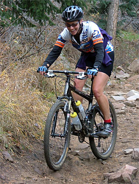
Typical of most Front Range riding, Deer Creek Canyon is a long out-and-back climb, but there are two really nice loops at the top (It's probably the longest climb on the Front Range that I've done - or is Mt. Falcon longer?) The trails are popular with hikers and bikers and are failry wide. There are some rocky and technical sections that can make for fun descents. The JeffCo website has an online map and a good acrobat printable map.
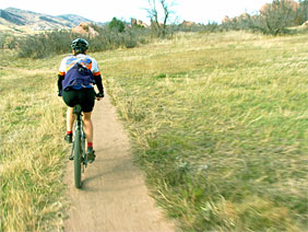
South Valley Park is much narrower singletrack in tall grass, on rolling ups and downs. There are no long climbs, and sadly no slickrock, even though there are glimpses of it near the trail. It's a fast trail for the experienced (unless there are a lot of hikers) and one of the best trails to bring someone new to mountain biking. The JeffCo website has an online map and a good acrobat printable map.
Elk Meadow
map | trails profile
Directions:
Drive west on I-70 to Evergreen. Exit on Evergreen Parkway and drive through Bergen Park. Stay on CO-74 for 3/4 miles and turn right into the Elk Meadows Open Space parking lot.
Flying J Ranch
Flying J Ranch Park / map / park vision
Green Mountain Trails
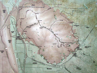
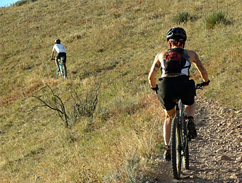
I've been riding Green Mountain mostly. It's very sunny, so you can ride there even when it's colder elsewhere, although it can be cold and windy exposed at the top. I am working on a map for Green Mountain, and have a picture of the map at the main trailhead, along with the history and rules at the bottom of this page.
Directions:
Drive west on 6th Ave. to Kipling. Turn south on Kipling to Alameda. Turn right (west) onto Alameda. Follow Alameda as it turns south and turn right into the trailhead parking lot.
If you are coming from C-470, exit at Morrison and turn right on S. Rooney, then turn right onto Jewell Ave. to Alameda.
William Frederick Hayden Green Mountain Park is a 2,300 acre open space park managed by the City of Lakewood. The mountain's steep terrain provides a challenging network of multiple-use trails. The summit (elevation 6,800 feet) offers unique views of the metropolitan area to the east, and high mountain peaks to the west.
Green Mountain is ecologically significant because of its location at the boundary of two distinct regions. At the western-most edge of the short grass prairie, Green Mountain is also a landmark entry to the Rockies, immediately to the west.
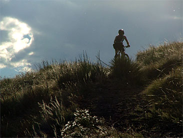
Historically this area was home to the buffalo, but now provides rich habitat for a diverse array of wildlife. Visitors to the mountain can observe much of this wildlife on a brief hike or ride. Black-tailed prairie dog towns occupy the base of the mountain, while predators such as coyotes, hawks, and rattlesnakes await nearby for the chance to snare a meal. Other wildlife includes meadowlarks, killdeer, bluebirds, rabbits, mule deer, and an occasional mountain lion.
The majority of Green Mountain has been either donated by or purchased from the Hayden family since 1972 with funding from Jefferson County Open Space and the City of Lakewood.
Hall Ranch
Near Lyons, Colorado. I have not yet ridden Hall Ranch, but will before it gets too cold!
Ken Caryl
map (5.7 MB) | trails profile
Ken Caryl Ranch is private property and not open for public use. Non-Residents are tresspassing and subject to fines by the ranger staff that patrol and maintain the property. That been said, i have ridden there a couple of times, and never had any problems. Someone told me to park at the Manor House restraunt. I was just informed that that parking lot is owned by the restaurant and they have been known to tow cars, but I don't know if that's true. It's up to you whether you want to ride there if you aren't a resident. If you live in Denver, instead of the oversized-plastic-house southern suburbs, there's plenty of better stuff that's closer and not subject to potential hassle. If you've ridden everything around and aren't averse to potential hassle, it's a nice trail and totally worth checking out.
Directions:
Take C-470 south to the Ken Caryl exit. Go west, into the canyon. Stay right at the "Y" and go about 1.3mi. Take the 2nd right after the "Y" onto Mountain Laurel Dr. You should see a sign to the Manor House. About 200 yds. up, take the next right onto Manor House Rd. and follow the signs to the Manor House, the large white house on the hill. Park at the far end of the lower lot, on the northeast side of the restaurant at your own risk.
Lair o' the Bear
Lair o' the Bear Park / map / trails profile
Matthews/Winters Park. See Dakota Ridge
Meyer Ranch
Meyer Ranch Park / map / trails profile
Mt. Falcon
map | trails profile
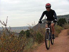
Mt. Falcon is a long uphill with some loop opportunities at the top. There are some historical castle ruins at the top for the history oriented. For the stronger riders, you can start in Morrison, and connect the top of Mt. Falcon to Lair of the Bear, then ride the road back down to Morrison.
Directions:
From Denver drive West on Hampden (US 285) or take C470 and exit Hampden West. Turn north onto CO 8 about a mile and a half from the C470/Hampden interchange. Drive 1 mile to Forest Ave and turn left. Follow the Open Space signs to Mt. Falcon Park.
Pine Valley Ranch
Pine Valley Ranch Park / map / trails profile / park vision
Reynolds Park
Reynolds Park / map / trails profile (Closed to Bicyclists)
Van Bibber
Van Bibber Park / map
Waterton Canyon
Directions:
Take C-470 to Wadsworth and turn south onto South Wadsworth. Take S. Wadsworth about 4 miles and turn left into the Waterton Canyon Recreation Area.
Windy Saddle
Windy Saddle Park / map
White Ranch
map | trails profile
Directions:
Drive west on 6th Ave. to Golden. Follow 6th Ave as it turns into CO-93. Drive north on CO-93 just past Golden and look for the brown "White Ranch Open Space" sign on the right. Turn left at the sign and follow the road until it ends at a T. Turn right into the parking lot.
TRAILS ARE FOR ALL NON-MOTORIZED USERS
BE CONSIDERATE OF OTHERS
- minimize your impact on the land, do not create trails, or leave ruts.
- yield the trail to uphill traffic
- give audible signals when passing
- keep right except to pass
- stay on designated trails
- carry out your litter
- be courteous and respectful of others, regardless of their mode of travel, speed, or level of skill
- do not block trails with pets or large groups
- yield when entering and crossing trails
- travel at a safe controlled speed
- watch for hazards along trails and throughout the park
- recommended maximum speed is 15 mph
- be alert! rattlesnakes live in this area and are often found on, or near trails.
| 