Porcupine Rim
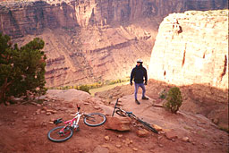
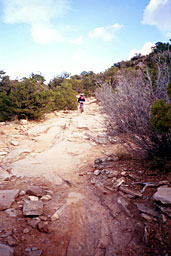
 The Porcupine Rim Trail is definitely my favorite ride in the Moab area. It's a great distance and has a little bit of everything. It has become really rocky and rutted from erosion from all of the use over the years.
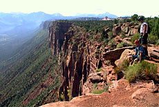
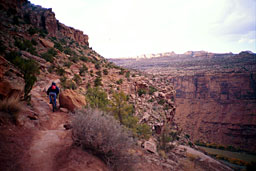
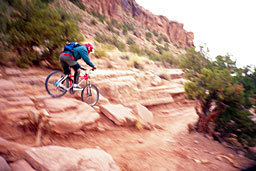
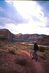
The trail is about five miles of gradual incline on an improved surface road that you can shuttle, followed by a couple mile nice rocky jeep road ascent to a beautiful view of Castle Valley from the rim. starting here is a very fast, no-brakes, jeep-road, descent. Motorized vehicles are allowed in all of these sections, but have never been a problem when I've been there. A sign marks the beginning of the singletrack section where motorized vehicles are no longer allowed. The single track slowly goes from fast and fun to very technical. This is where it can get dangerous. Eventually, after a couple of dismounts, it mellows out and hits route 128. Take a left and ride about four miles to 191. Take a left and cruise back into town.
If you don't want to ride up from town, the two shuttle companies to use are Acme or Coyote.
Acme: 435.260.2534
leaves from the Chile Pepper Bike Shop
702 South Main st.
Coyote: 435.259.8656.
Both are owned by mountain bikers, are very friendly, and can give tips and advice. Both charge around $10 per person and do airport runs as well. You'll have to pay to get in to the Sand Flats Recreation area whether you bike, drive, or shuttle.
Like all desert riding, the Porcupine Rim trail can be very dangerous. People die on this trail more often than you'd think. It's usually due to exposure and dehydration, but people have died on this trail and others from trying to play macho and outdo their buddies. If the section looks sketchy and you don't want to do it, get off your bike.
Please ride safe and bring more water than you think you could ever drink. Just in August of 2000, a 13 year old kid out riding Porcupine with his father and brother died of exposure after getting separated from the group. It took rescue crews several days to find the body.
The Porcupine Rim trail can be found on the fantastic Latitude 40 Moab East map that also includes the Slickrock trail, a lot of the end of the Kokopelli, and much more.
You can print my Porcupine Rim Trial map and then buy a map holder from www.cycoactive.com. I'm still working on the map, but I think that it's already useable.
| 

 Porcupine Rim Map