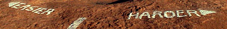
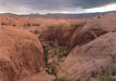
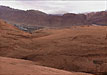
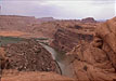
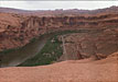
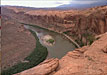
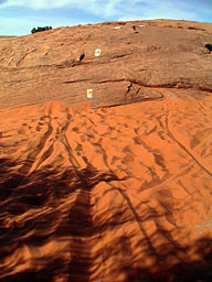
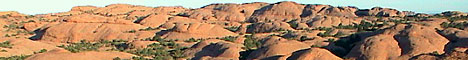
the Slickrock Trail
 The history of the slickrock trail goes way back to July 22, 1969, when Dick Wilson, "Mr. Slickrock" founded the trail with the help of the BLM for motorcycle use. A lot has changed since then!
Slickrock has become so popular, that during the 90's, the whole Sand Flats Recreation area went from a free access, camp anywhere area, to a pay access, pay camping at numbered, reserved sites. If you ever get the chance to do the trail, it's absolutely worth it.
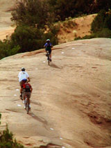
 Everytime I'm there, I see everything from people new to biking all the way to kids born after the first time I mountain biked on fat, freeride bikes that can kick my ass. If you're a strong rider, get out and do the main loop. If you're not, just do the practice loop and go get some. Trying to do both for a novice is too much. The problem is that a large number of riders are good riders bringing friends or spouses that aren't as strong or experienced. Be very careful when making your decisions for groups of mixed abilities. You can't walk out of the slickrock trail. Everytime I'm there, I see everything from people new to biking all the way to kids born after the first time I mountain biked on fat, freeride bikes that can kick my ass. If you're a strong rider, get out and do the main loop. If you're not, just do the practice loop and go get some. Trying to do both for a novice is too much. The problem is that a large number of riders are good riders bringing friends or spouses that aren't as strong or experienced. Be very careful when making your decisions for groups of mixed abilities. You can't walk out of the slickrock trail.
 The slickrock trail is the most fun in the spring and fall. Ice on north-facing slopes can make it dangerous in the winter, even on warmer days. Summer days can be miserably hot, actually, dangerously hot. Don't ride there at all in August and late July if you don't have to. If you're there near that period, try and get on the trail before 7:00 AM and be off the trail before 11:00 AM. I've done that before and just relaxed the rest of the day, and had a great week. The occasional overcast day can give you a full day surprise and let you ride the side trails. Just don't expect it, there's lots and lots of sun here.
Please ride safe and bring more water than you think you could ever drink. I did the trail in August many, many years ago and barely made it. We brought four gallons for two people. We ran out of water over a mile before the end and basically had heat exhaustion. This was at the peak of my fitness at 19 years old.
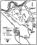
Latitude 40 has a great Slickrock trail map that is drawn atop an aerial photograph.
You can print my Slickrock Trial map and then buy a map holder from www.cycoactive.com. I'm still working on the map, but I think that it's already useable.
If you are good with GPS, then try downloading my slickrock waypoints list. I don't know how to upload them, so don't ask. If you know how, tell me, and I'll include instructions here.
|